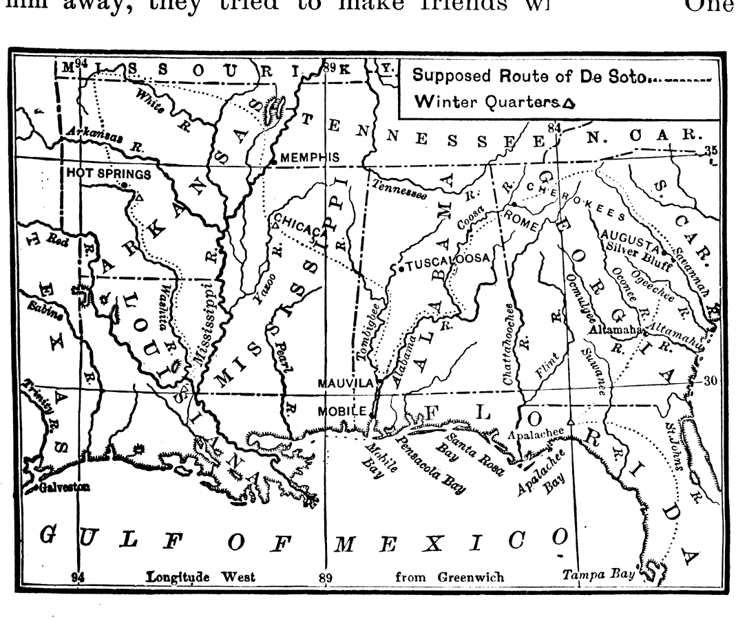
Description: Map shows the landing site of Hernando De Soto at Tampa Bay and the route he traveled to explore the southeastern states of the U.S. Locates all major rivers he found and the gulf of Mexico.
Place Names: 1900-1919, Apalachee, Tampa
ISO Topic Categories: boundaries, oceans, inlandWaters, transportation
Keywords: Route of De Soto, physical, historical, physical features, boundaries, oceans, inlandWaters, transportation, Unknown,1539
Source: Caroline Mays Brevard, A History of Florida (New York, NY: American Book Company, 1919) 31
Map Credit: Courtesy the private collection of Roy Winkelman |
|