mapsExploring Florida
 FL Maps > Region > 1740-1759 > Campaigns of Oglethorpe and Monteano, March 1743 C.E.
Site Map 

Campaigns of Oglethorpe and Monteano, March 1743 C.E.

Campaigns of Oglethorpe and Monteano


Title: Campaigns of Oglethorpe and Monteano
Projection: Unknown
Source Bounding Coordinates:
W: E: N: S:

Main Map Page
Zoomify Version
B/W PDF Version
Puzzles: Easy, Medium, Hard
Google Earth
GIS Files
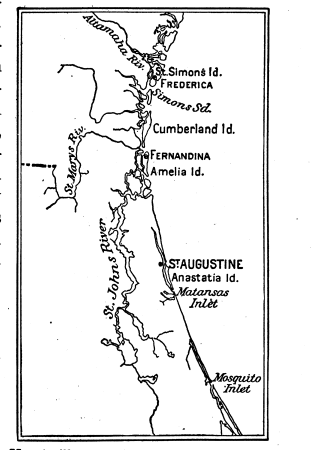
Description: Map shows the campaigns of Oglethorpe and Monteano in the early 1700's C.E.
Place Names: 1740-1759, Saint Augustine, Fernandina
ISO Topic Categories: oceans, inlandWaters, society
Keywords: Campaigns of Oglethorpe and Monteano, physical, historical, physical features, oceans, inlandWaters, society, Unknown,March 1743 C.E.
Source: Caroline Mays Brevard, A History of Florida (New York, NY: American Book Company, 1919) 75
Map Credit: Courtesy the private collection of Roy Winkelman
SearchLicensePDF HelpGIS Help Google Earth Help Zoomify Help

 FL Maps > Region > 1740-1759 > Campaigns of Oglethorpe and Monteano, March 1743 C.E.
Site Map