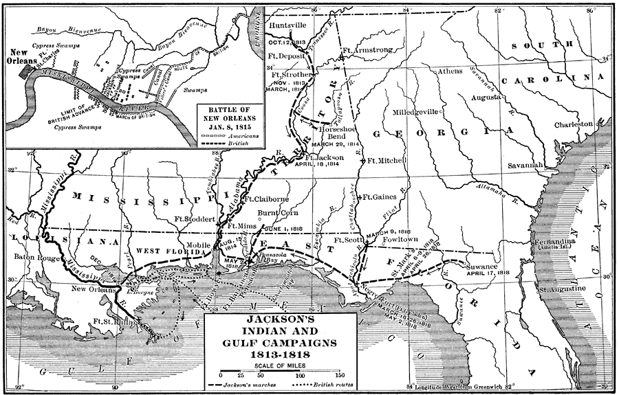
Description: Map shows Jackson's campaign routes throught Florida and the southeastern states of the U.S. Shows all major forts in 1813 and the Battle of New Orleans in 1815.
Place Names: 1800-1819, Saint Augustine, Suwanee, Fernandina, Pensicola
ISO Topic Categories:
Keywords: Jackson's Indian and Gulf Campaigns, physical, political, historical, physical features, major political subdivisions, Unknown,1813
Source: Kendric Charles Babcock, The American Nation a History Volume 13 (New York , NY: Harper & Brothers Publishers, 1906) 277
Map Credit: Courtesy the private collection of Roy Winkelman |
|