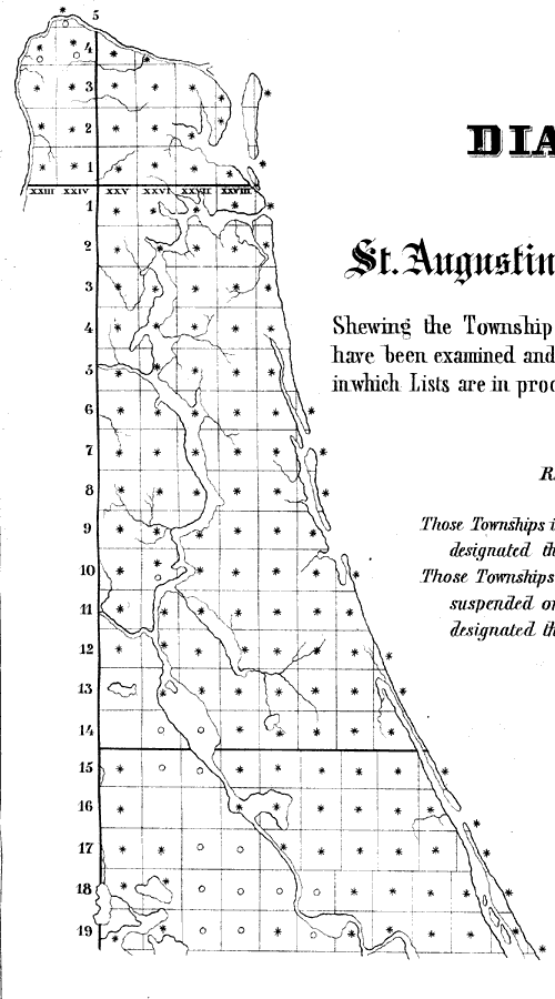
Description: A map of the St. Augustine Land District "Shewing the Townships in which Swamp Land Lists have been examined and approved, also those Townships in which Lists are in process of examination." The Township and Range grid is taken from the Tallahassee Baseline and Tallahassee Meridian.
Place Names: 1840-1859, Jacksonville, Saint Augustine
ISO Topic Categories: boundaries, inlandWaters, planningCadastre, oceans
Keywords: Diagram of St. Augustine Land District, physical, political, physical features, local jurisdictions, boundaries, inlandWaters, planningCadastre, oceans, Unknown,1855
Source: A. Hoen, Sen. Ex. Doc. No 1, 34th Cong: 1st Sess. (Washington, DC: U.S. Government Land Office, 1855)
Map Credit: Courtesy the private collection of Roy Winkelman |
|