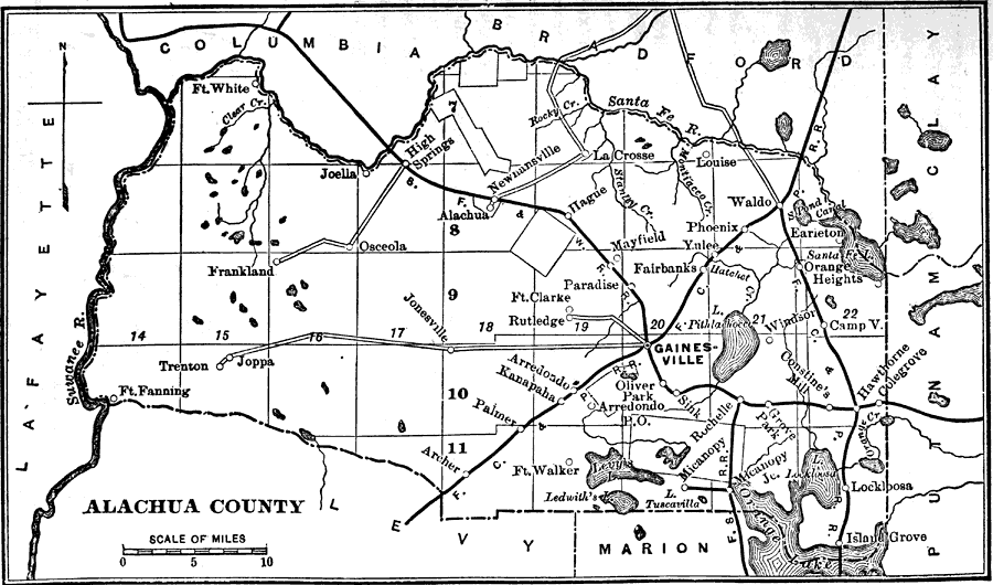
Description: Map shows Alachua County in 1890 . Shows all cities, towns, roads, railroads, lakes and rivers in Alachua County as of 1890 . Shows all counties that surround Alachua County.
Place Names: Alachua, Alachua, Archer, Gainsville, Kanapaha, Micanopy, Newnansville, Waldo , High Springs
ISO Topic Categories: boundaries, inlandWaters, transportation
Keywords: Alachua County, physical, political, historical, transportation, physical features, county borders, railroads, roads, boundaries, inlandWaters, transportation, Unknown,1890
Source: Charles Ledyard Norton, A Handbook of Florida (New York, NY: Longmans, Green, & Co., 1890) 3
Map Credit: Courtesy the private collection of Roy Winkelman |
|