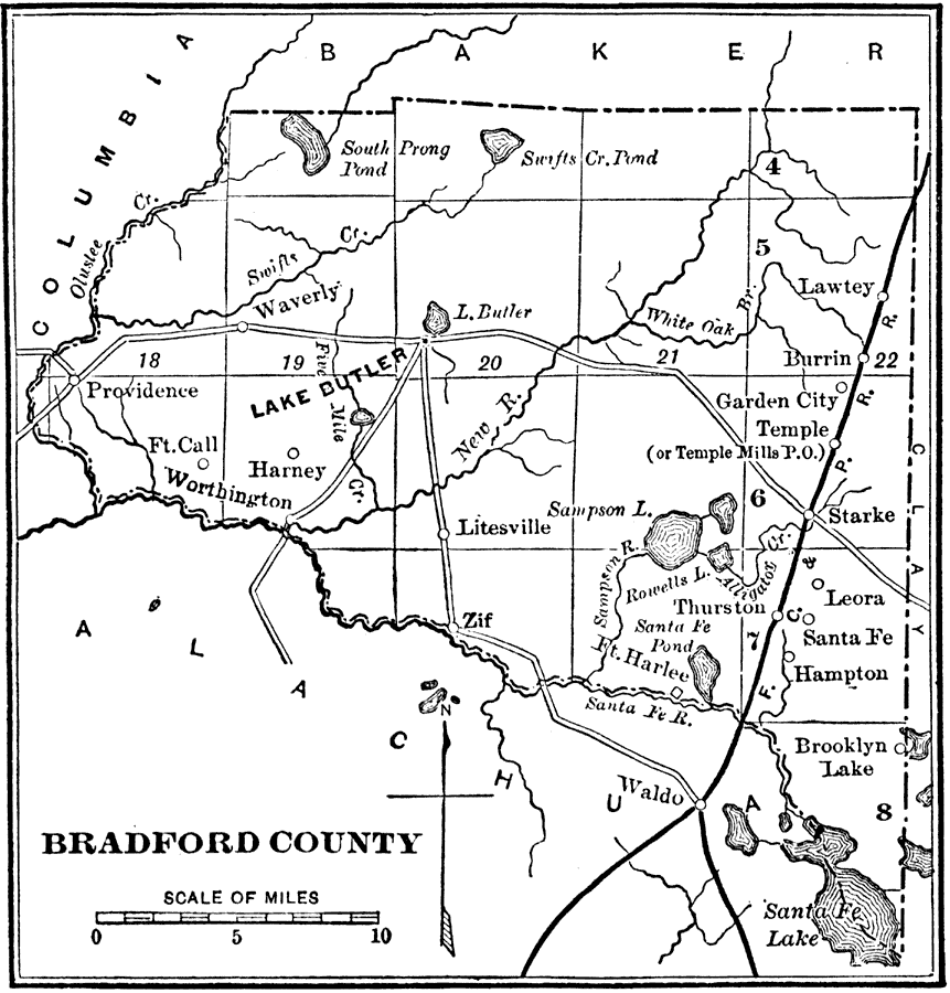
Description: Map shows Bradford County in 1890. Shows all major roads, railroads, lakes, rivers, cities and towns in 1890. Shows all counties that surround Bradford County.
Place Names: Bradford, Lake Butler, Ft Harley, Hampton, Santa Fe River, Lawtey, Ft Call, Starke, Zif
ISO Topic Categories: boundaries, transportation, inlandWaters
Keywords: Bradford County, physical, political, transportation, historical, physical features, county borders, roads, railroads, boundaries, transportation, inlandWaters, Unknown,1890
Source: Charles Ledyard Norton, A Handbook of Florida (New York, NY: Longmans, Green, & Co., 1890) 8
Map Credit: Courtesy the private collection of Roy Winkelman |
|