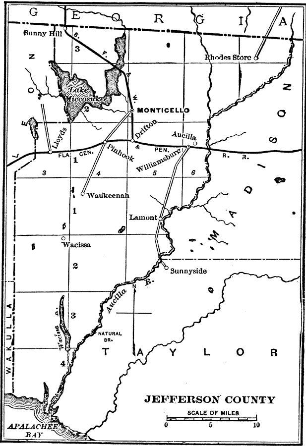
Description: A map of Jefferson County showing the county seat (Monticello), cities, towns, rivers, lakes, roads, and railroads present in 1890.
Place Names: Jefferson, Monticello, Drifton, Pinhook, Lloyd, Aucilla, Lamont, Rhodes Store, Waukeenah, Wacissa
ISO Topic Categories: oceans, transportation, inlandWaters, boundaries
Keywords: Jefferson County, physical, political, transportation, physical features, major political subdivisions, county borders, railroads, roads, oceans, transportation, inlandWaters, boundaries, Unknown,1890
Source: Charles Ledyard Norton, A Handbook of Florida (New York, NY: Longmans, Green, & Co., 1890) 42
Map Credit: Courtesy the private collection of Roy Winkelman |
|