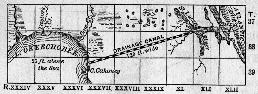
Description: Map of the area between Lake Okeechobee and the Atlantic Ocean showing the proposed canal to connect Lake Okeechobee to the St. Lucea River. Proposed canal is 120 feet wide and 10 feet deep and begins at Cahoney Bay in Okeechobee. Area divided into townships and ranges based on the Tallahassee meridian and parallel.
Place Names: St. Lucia, Lake Okechobee, St. Lucea River, Kissimmee River
ISO Topic Categories: inlandWaters
Keywords: Map of Okeechobee Drainage Canal, physical, physical features, local jurisdictions, inlandWaters, Unknown,1884
Source: Will Wallace Harney, Harper's New Monthly Magazine: Drainage of the Everglades (New York, NY: Harper & Bros., 1884) 604
Map Credit: Courtesy the Private Collection of Roy Winkelman |
|