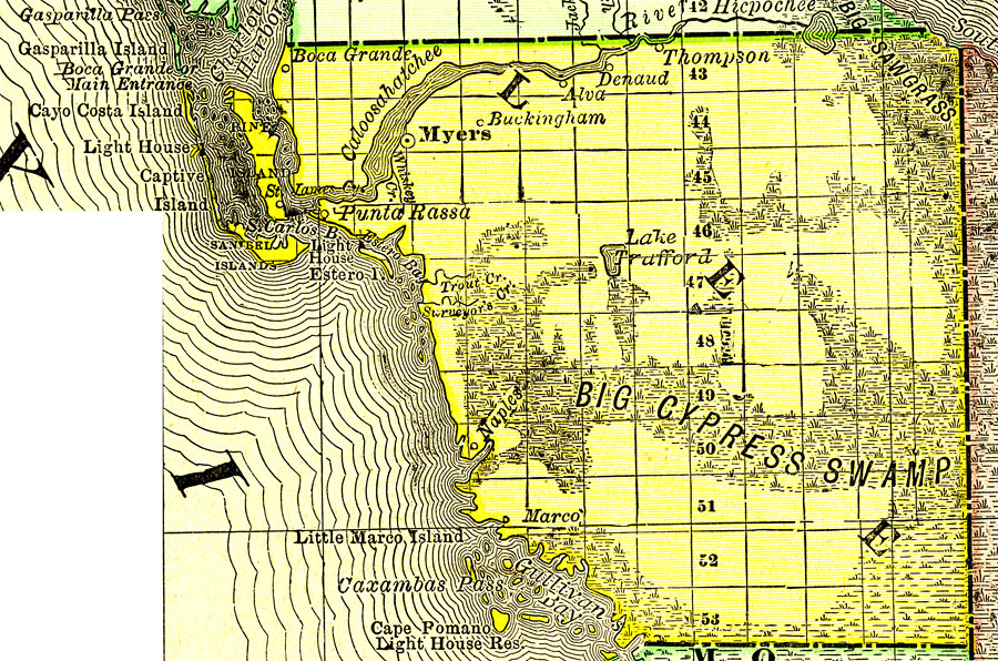
Description: A map of Lee County showing county lines, the county seat (Myers), Big Cypress Swamp, and cities current to 1888.
Place Names: Lee, Ft. Myers, Punta Rassa, Alva, Boca Grande
ISO Topic Categories: oceans, inlandWaters, boundaries
Keywords: Lee County, physical, political, physical features, county borders, oceans, inlandWaters, boundaries, Unknown,1888
Source: , Atlas of the World (Chicago, IL: Rand McNally & Co., 1888)
Map Credit: Courtesy the private collection of Roy Winkelman |
|