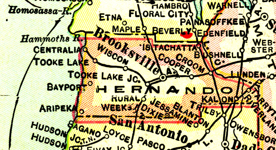
Description: This map of Hernando County shows the county seat (Brooksville), county boundaries, wetlands, railroads, and cities current to 1916.
Place Names: Hernando, Brooksville, Bayport, Tooke Lake, Croom
ISO Topic Categories: boundaries, transportation, inlandWaters, oceans
Keywords: Hernando County, physical, political, transportation, physical features, county borders, railroads, boundaries, transportation, inlandWaters, oceans, Unknown,1916
Source: , (Indianapolis, IN: National Map Company, 1916)
Map Credit: Courtesy the private collection of Roy Winkelman. |
|