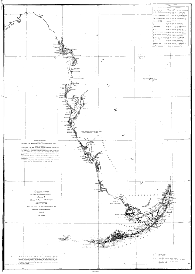
Description: Chart showing the west coast of Florida and the Keys with sailing directions including bearings, soundings, and a table of latitudes and longitudes. The map also shows the Mosquito Inlet and Cape Canaveral along the Atlantic Coast. Detailed triangulations are shown for the Florida Keys. A Native American District is shown just to the east of Charlotte Harbor as well as Indian hunting grounds at the southern tip of the Everglades. Surveyed by F. H. Gerdes. The mapscale is 1:1,200,000.
Place Names: 1840-1859, Cedar Key, Cape Canaveral, Mosquito Inlet, Miami, Cape Florida, Key Largo, Card Sound, Cape Sable, Key West, Dry Tortugas, Cape Romano, Charlotte Harbor, Anna Maria Key, Tampa Bay, Egmont Key, Anclote Keys,
ISO Topic Categories: transportation
Keywords: A General Reconnoissance of the Western Coast of Florida, physical, transportation, physical features, water routes, transportation, Unknown,1851
Source: F.H. Gerdes, U.S. Coast Survey (Washington, DC: Government Printing Office, 1851)
Map Credit: Courtesy the private collection of Roy Winkelman |
|