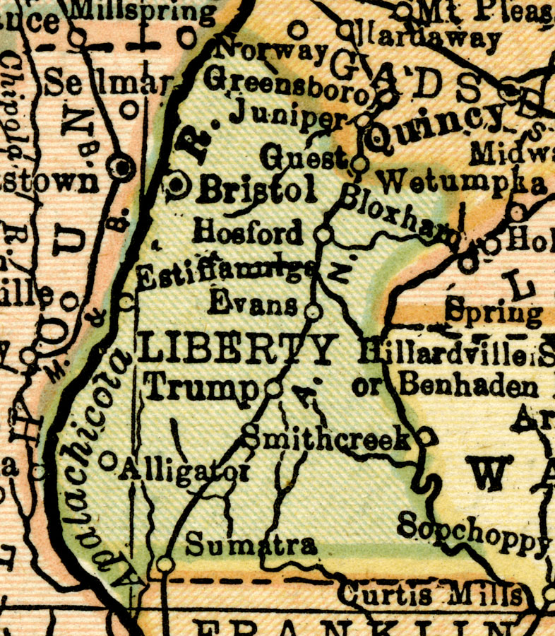
Description: This map of Liberty County shows the county seat (Bristol), railroads, and cities current to 1920.
Place Names: Liberty, Hosford, Bristol, Sumatra, Alligator, Estiffanulga
ISO Topic Categories: boundaries, transportation, inlandWaters
Keywords: Liberty County, physical, political, transportation, swamps, everglades, wetlands, physical features, county borders, railroads, boundaries, transportation, inlandWaters, Unknown,1920
Source: , Leslie's New World Atlas (New York, NY: Leslie-Judge Company, 1920)
Map Credit: Courtesy the private collection of Roy Winkelman. |
|