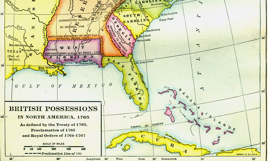
Description: A map showing East Florida and West Florida circa 1765. East Florida is defined as the land east of the Apalachicola River. To the north of the Florida boundary are lands reserved for American Indians and to the northeast lands annexed to Georgia by the proclamation of 1763. West Florida lies between the Apalachicola River in the east to the Mississippi River in the west. The northern boundary is shown according to the proclamation of 1763, and the northward extension by Royal Order in 1767.
Place Names: 1720-1839, Saint Augustine
ISO Topic Categories: boundaries, inlandWaters, oceans
Keywords: British Possessions in North America, political, British land claims, major political subdivisions, boundaries, inlandWaters, oceans, Unknown,1763 to 1767
Source: Dixon Ryan Fox, Harper's Atlas of American History (New York, NY: Harper and Brothers, 1920) 16
Map Credit: Courtesy the private collection of Roy Winkelman. |
|