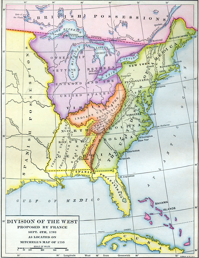
Description: A map of Florida as a Spanish possession stretching from the Mississippi River eastward to the Atlantic Ocean. To the north of Florida are American Indian lands under the protection of the Spanish, a small area of American Indian lands under the protection of the United States, and in the East, the southern United States. These are the divisions proposed by France in 1782.
Place Names: 1780-1799, Saint Augustine
ISO Topic Categories: boundaries, inlandWaters, oceans
Keywords: Division of the West, political, Spanish possessions, major political subdivisions, boundaries, inlandWaters, oceans, Unknown,1782
Source: Dixon Ryan Fox, Harper's Atlas of American History (New York, NY: Harper and Brothers, 1920) 20
Map Credit: Courtesy the private collection of Roy Winkelman. |
|