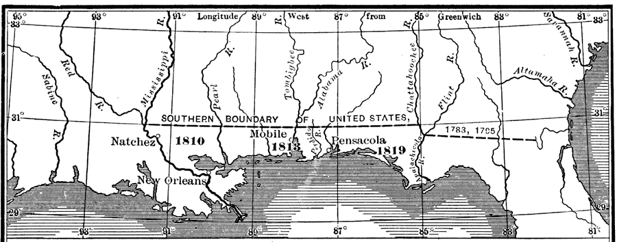
Description: "In 1810 Madison by proclamation annexed West Florida to the Perdido; but it was occupied only to the Pearl. In 1812 this part of West Florida was admitted to the Union as a portion of Louisiana. In 1813 Mobile and the country to the Perdido was occupied. In 1819 by treaty Spain ceded all territory claimed by her, east of the Mississippi, to the United States." — Fox, 1920
Place Names: 1800-1819, Pensacola, Mobile, New Orleans, Natchez
ISO Topic Categories: boundaries, inlandWaters, oceans
Keywords: West Florida, physical, political, physical features, major political subdivisions, boundaries, inlandWaters, oceans, Unknown,1803 to 1819
Source: Dixon Ryan Fox, Harper's Atlas of American History (New York, NY: Harper and Brothers, 1920) 26
Map Credit: Courtesy the private collection of Roy Winkelman. |
|