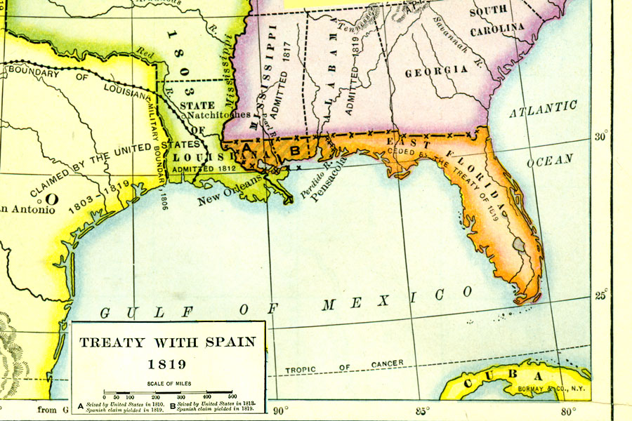
Description: A map of Florida and southern states at the time of the treaty between Spain and the United States in 1819. The map shows the lands seized by the United States in 1810 and 1813, which Spain ceded along with the remainder of Florida by the treaty of 1819.
Place Names: 1720-1839,
ISO Topic Categories: boundaries, inlandWaters, oceans
Keywords: Treaty with Spain, physical, political, physical features, major political subdivisions, boundaries, inlandWaters, oceans, Unknown,1819
Source: Dixon Ryan Fox, Harper's Atlas of American History (New York, NY: Harper and Brothers, 1920) 30
Map Credit: Courtesy the private collection of Roy Winkelman. |
|