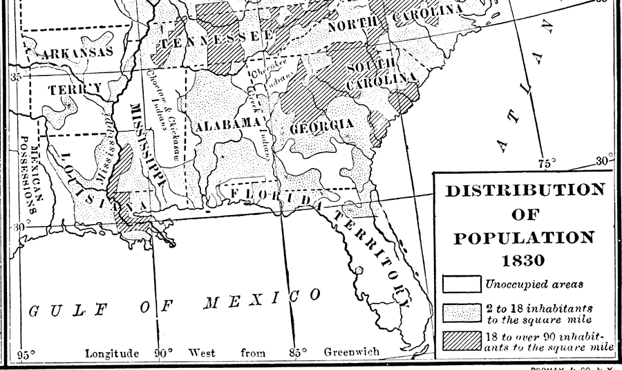
Description: A map showing the population distribution in the Florida Territory and neighboring southern states in 1830. According to this map, only the northern-most tier of the Florida Territory was occupied, with a population density estimated at between 2 and 18 inhabitants per square mile.
Place Names: 1820-1839, Saint Augustine
ISO Topic Categories:
Keywords: Distribution of Population, physical, political, statistical, physical features, major political subdivisions, population, Unknown,1830
Source: Dixon Ryan Fox, Harper's Atlas of American History (New York, NY: Harper and Brothers, 1920) 33
Map Credit: Courtesy the private collection of Roy Winkelman. |
|