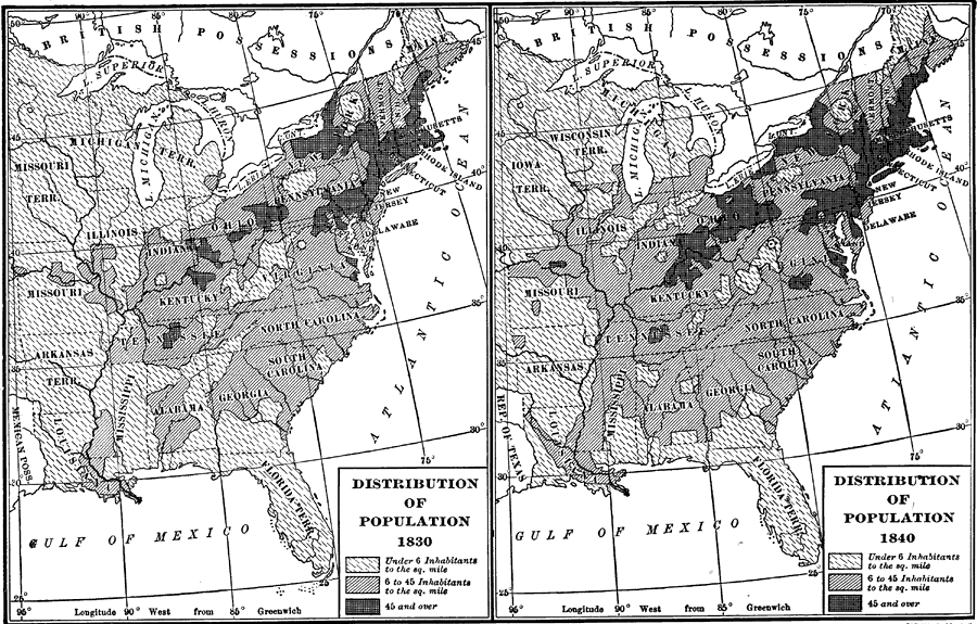
Description: These two maps show the population distribution between 1830 and 1840. While the overall population density in the Florida Territory remained under 6 inhabitants per square mile for this period, the southerly population increase in the Gulf Coast states can be seen.
Place Names: 1820-1839,
ISO Topic Categories: boundaries, inlandWaters, oceans, society
Keywords: Distribution of Population, physical, political, statistical, physical features, country borders, major political subdivisions, population, boundaries, inlandWaters, oceans, society, Unknown,1830 to 1840
Source: Dixon Ryan Fox, Harper's Atlas of American History (New York, NY: Harper and Brothers, 1920) 40
Map Credit: Courtesy the private collection of Roy Winkelman. |
|