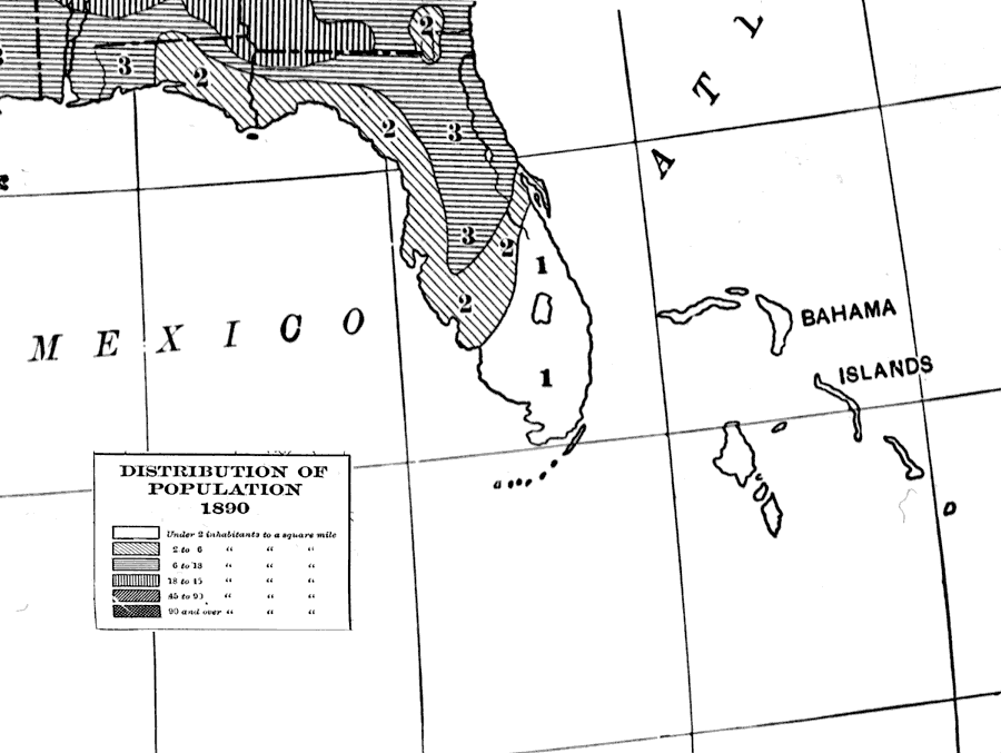
Description: Map indicates the population distribution throughout Florida in the year 1890 C.E. Different regions of Florida are indicated with having populations ranging from under 2 inhabitants per square mile to having up to 45 inhabitants per square mile.
Place Names: 1880-1899,
ISO Topic Categories: society, economy, boundaries, oceans
Keywords: Distribution of Population, physical, political, statistical, historical, physical features, country borders, major political subdivisions, population, society, economy, boundaries, oceans, Unknown,1890
Source: Dixon Ryan Fox, Harper's Atlas of American History (New York, NY: Harper and Brothers, 1920) 68
Map Credit: Courtesy the private collection of Roy Winkelman. |
|