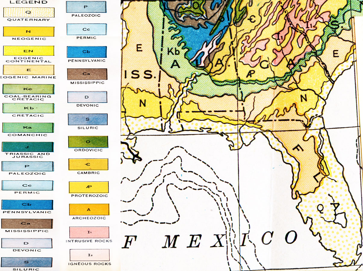
Description: Geological map of Florida taken from the Geologic Map of North America by the US Geological Survey, 1911. Shows geological formations as classified by C. Schuchert. For the state of Florida and area immediately north these formations include Quaternary, Eogenic Marine, Neogenic, Cretacic, Pennsylvanic, Intrusive Rocks, Cambric, and Mississippic.
Place Names: 1900-1919, Tampa, Tallahassee, Jacksonville
ISO Topic Categories: boundaries, inlandWaters, oceans
Keywords: Geologic Map of Florida, physical, political, physical features, geological, major political subdivisions, boundaries, inlandWaters, oceans, Unknown,1911
Source: Isaiah Bowman, Ph.D., Forest Physiography (New York, NY: John Wiley & Sons, 1911)
Map Credit: Courtesy the private collection of Roy Winkelman |
|