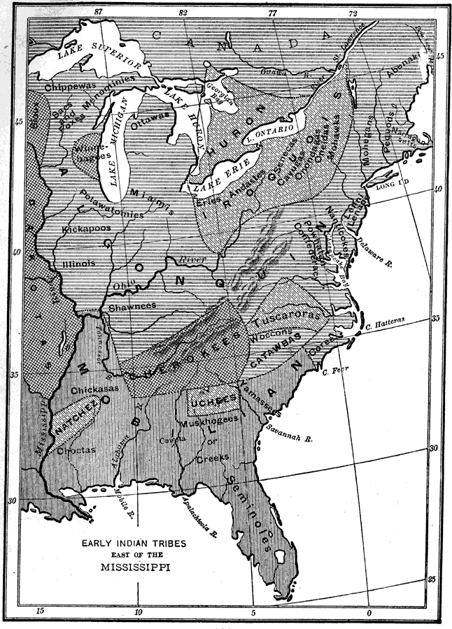
Description: A map of the three major Native American confederacies and tribes in North America east of the Mississippi River at the time of the early explorers. The map shows Florida to be in the Mobilian confederacy, with the Seminole tribe predominately in peninsular Florida and the Creek tribe in the panhandle region of the state.
Place Names: State, Seminole
ISO Topic Categories: boundaries, inlandWaters, oceans, society
Keywords: Early Indian Tribes East of the Mississippi, physical, political, statistical, physical features, local jurisdictions, ethnological, boundaries, inlandWaters, oceans, society, Unknown,1600
Source: Alma Holman Burton, The Story of Our Country (New York, NY: American Book Company, 1896) 106
Map Credit: Courtesy the private collection of Roy Winkelman |
|