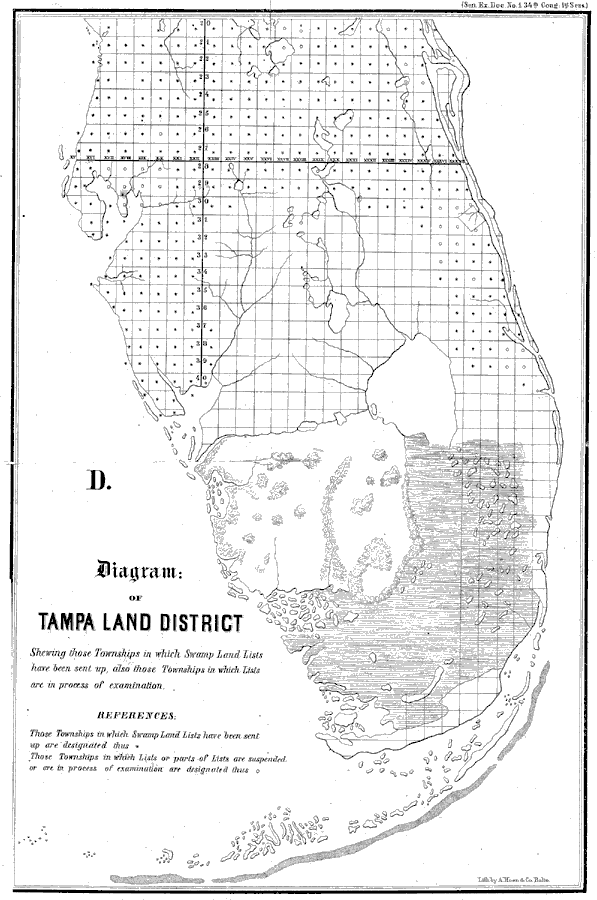
Description: A map of Central and Southern Florida "Shewing those Townships in which Swamp Land Lists have been sent up, also those Townships in which Lists are in process of examination."—A. Hoen, 1855Townships with Swamp Land Lists are designated with a star. Townships with Lists or parts of Lists that are suspended or in the process of examinated are designated with a circle.
Place Names: 1840-1859,
ISO Topic Categories: oceans, inlandWaters
Keywords: Diagram of Tampa Land District, physical, physical features, oceans, inlandWaters, Unknown,1855
Source: , Diagram of Tampa Land District (, : A. Hoen & Co., 1855)
Map Credit: Courtesy the private collection of Roy Winkelman. |
|