mapsExploring Florida
 FL Maps > County > Manatee > Manatee County, circa 1880
Site Map 

Manatee County, circa 1880

Manatee County


Title: Manatee County
Projection: Unknown
Source Bounding Coordinates:
W: E: N: S:

Main Map Page
Zoomify Version
B/W PDF Version
Color PDF Version
Puzzles: Easy, Medium, Hard
Google Earth
GIS Files
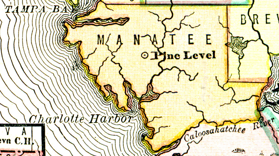
Description: A map of Manatee County showing county lines, the county seat (Pine Level), and cities current to the 1880s.
Place Names: Manatee, Pine Level
ISO Topic Categories: oceans, inlandWaters, boundaries
Keywords: Manatee County, political, physical, physical features, county borders, oceans, inlandWaters, boundaries, Unknown,circa 1880
Source: , (, : , 1880) 52
Map Credit: Courtesy the private collection of Roy Winkelman.
SearchLicensePDF HelpGIS Help Google Earth Help Zoomify Help

 FL Maps > County > Manatee > Manatee County, circa 1880
Site Map