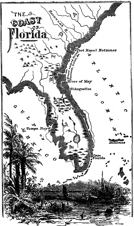
Description: A map of Spanish Florida extending northward beyond the Florida peninsula into South Carolina and Port Royal. On this map the St. Johns river is labeled the River of May, with other rivers between St Augustine and Port Royal shown with French names such as Seine, Garonne, and Loivre.
Place Names: 1720-1739, Saint Augustine, River of May, Tampa
ISO Topic Categories: inlandWaters, oceans
Keywords: The Coast of Florida, physical, physical features, inlandWaters, oceans, Unknown,1736 to 1742
Source: Benson J. Lossing, An Outline History of the United States (New York, NY: Sheldon and Company, 1878) 124
Map Credit: Courtesy the private collection of Roy Winkelman |
|