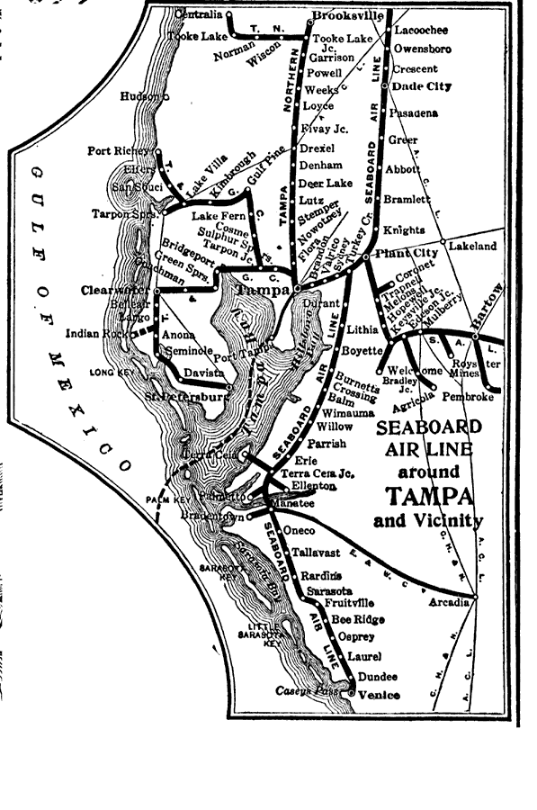
Description: Route map of the Seaboard Air Line Railroad in the Tampa Bay area current to 1916. The coverage area includes portions of Pasco, Pinellas, Hillsborough, Polk, and Manatee counties. This map shows connecting railroad lines and the shipping route out of Tampa Bay to Key West.
Place Names: Hillsborough, Brandon, Valrico, Tampa, Sulphur Springs, Seffner, Plant City
ISO Topic Categories: transportation
Keywords: Seaboard Air Line Railroad and Connections, physical, transportation, physical features, railroads, transportation, Unknown,1917
Source: Francis J. Reynolds, The New Encyclopedic Atlas and Gazetteer of the World (New York, NY: P. F. Collier and Son, 1917) 264
Map Credit: Courtesy the private collection of Roy Winkelman |
|