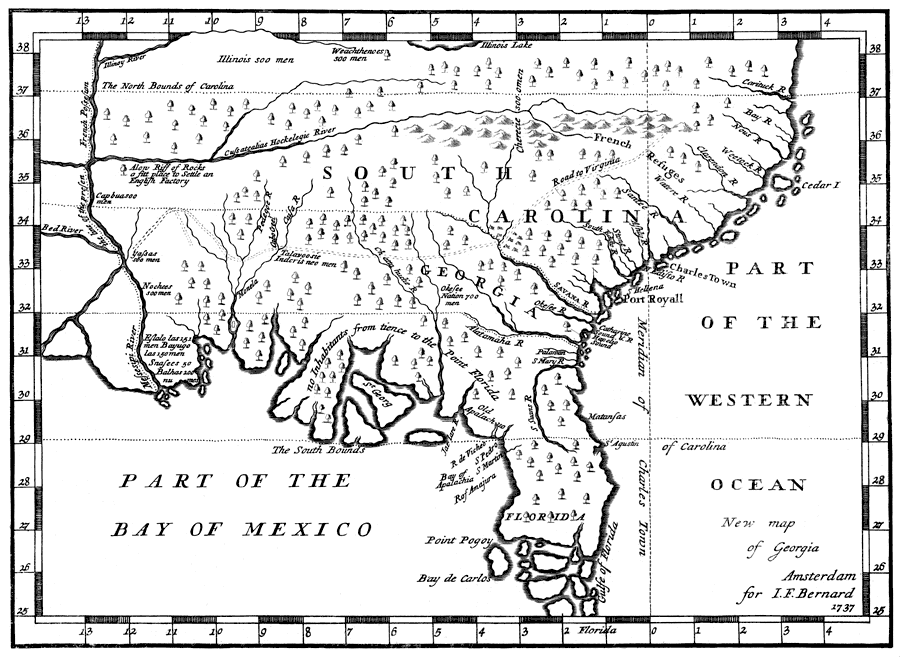
Description: Digitization provided by the USF Libraries Digitization Center. Rare Maps Collection: Notes from USF Library:Relief shown pictorially. Rare example of earliest views of South FloridaScale [ca. 1:9,000,000]Measurements.Dimensions: 19 x 25 cm
Place Names: 1720-1839, Saint Augustine
ISO Topic Categories: inlandWaters, oceans, society, transportation
Keywords: New map of Georgia, physical, statistical, historical, physical features, topographical, population, inlandWaters, oceans, society, transportation, Unknown,1737
Source: Jean FrŽdŽric Bernard, Bernard (J.F.) Recueil de voiages. 160. Amsterdam, 1737. v. 9. DŽcouverte d'un pays plus grand que l'Europe, situŽ dans l'AmŽrique .../ par le P. Hennepin, (p. 1-464 ˆ la fin du vol.) (Amsterdam, : J.F. Bernard , 1737)
Map Credit: Courtesy of the Special Collections Department, University of South Florida. |
|