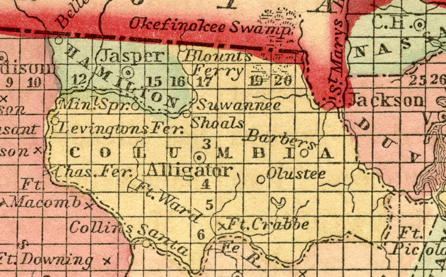
Description: A map of Columbia County as of 1857 showing forts, rivers, cities, and the county seat.
Place Names: Columbia, Alligator, Suwannee Shoals, Blount's Ferry, Ft. Ward, Ft. Crabbe
ISO Topic Categories: boundaries, inlandWaters
Keywords: Columbia County, physical, political, physical features, major political subdivisions, county borders, boundaries, inlandWaters, Unknown,1857
Source: Charles W. Morse, Diamond Atlas (New York, NY: Samuel Gaston , 1857)
Map Credit: Courtesy the private collection of Roy Winkelman |
|