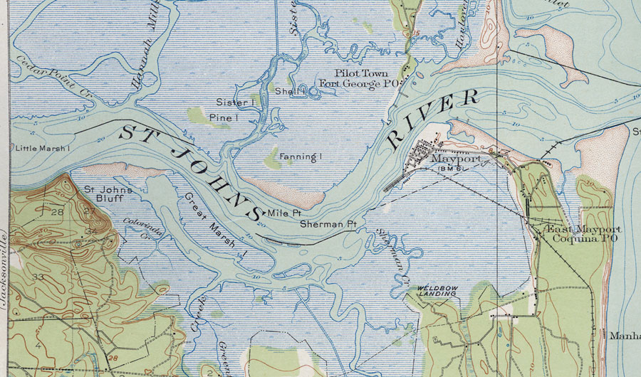
Description: This is a map of the Mouth of the St. Johns River in Duval County, Florida. It shows elevation, roads, railroads, inland waters and locations of dwellings. Detail view from a United States Geological Survey map. Key to USGS maps.
Place Names: Duval, St. Johns River, Sherman Point, Mile Point, St. Johns Bluff, Cedar Point Creek, East Mayport Coquina PO, Mayport, Pilot Town Fort George PO, Fanning Island, Sister Island, Pine Island, Sherman Creek, Colorado Creek, Little Marsh Island, Great Marsh Island
ISO Topic Categories: elevation, location, inlandWaters, transportation
Keywords: Mouth of St. Johns River, physical, transportation, topographical, roads, railroads, elevation, location, inlandWaters, transportation, Unknown,1918
Source:
Map Credit: Courtesy of the Pennsylvania State University Library's Map Library |
|