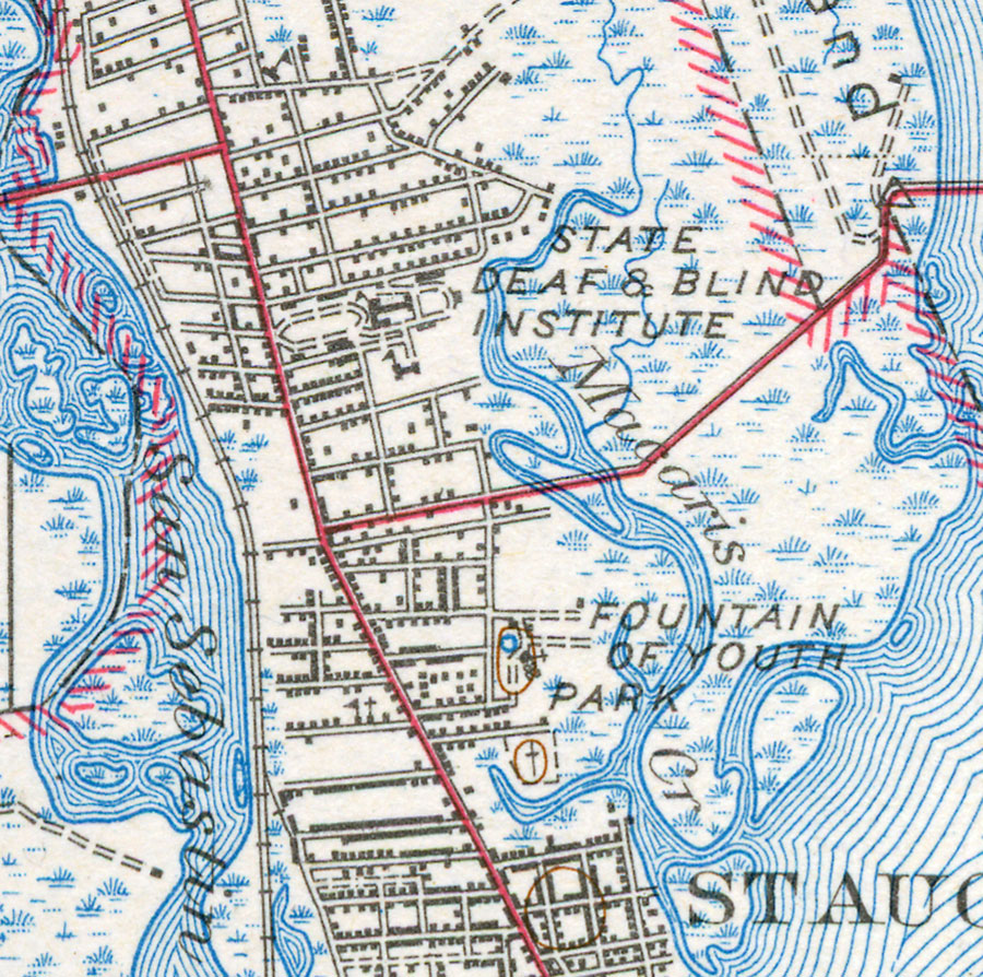
Description: This is a map of North St. Augustine in St. Johns County, Florida. It shows elevation, roads, railroads, inland waters and locations of dwellings, churches, schools, State Deaf and Blind Institute, Fountain of Youth Park and more. Detail view from a United States Geological Survey map. Key to USGS maps.
Place Names: St. Johns, St Augustine, North St. Augustine, San Sebastian River, Macaris Creek
ISO Topic Categories: elevation, location, transportation, inlandWaters
Keywords: North St. Augustine, physical, transportation, topographical, roads, railroads, elevation, location, transportation, inlandWaters, Unknown,1943
Source:
Map Credit: Courtesy of the Pennsylvania State University Library's Map Library |
|