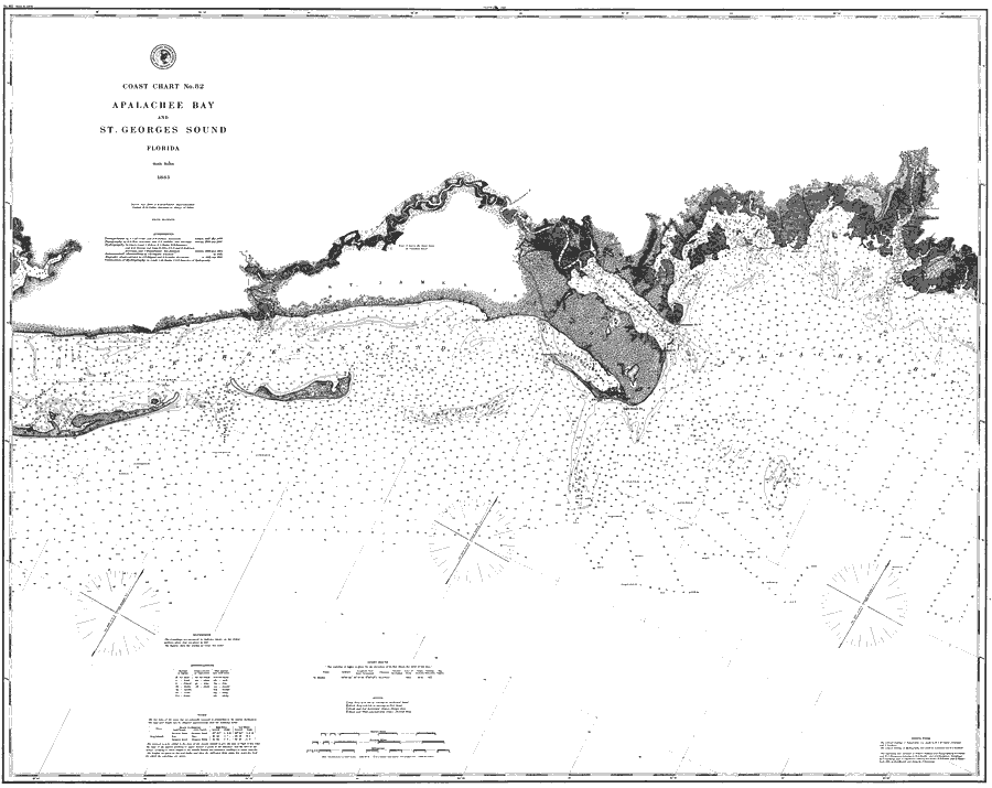
Description: A map of Apalachee Bay showing the Saint George Sound and Ocklockonee Bay waterways and near-shore water depths current to 1883. Soundings in deep waters are expressed in fathoms and shallow waters in feet. Variances in land surface features including dunes and wetlands are shown with stippling. The map scale is 1:80,000. Key to NOAA maps.
Place Names: Franklin, Ocklocknee, Saint James Island, St Marks Lighthouse, Apalachee Bay, Dog Island,
ISO Topic Categories: inlandWaters, oceans
Keywords: Coast Chart No. 82: Apalachee Bay and St. Georges Sound, physical, transportation, hydrological, physical features, topographical, water routes, water depths, inlandWaters, oceans, Unknown,1883
Source: J.E. Hilgard, (Washington, DC: United States Coast and Geodetic Survey, 1883)
Map Credit: Courtesy the U.S. National Oceanic and Atmospheric Administration |
|