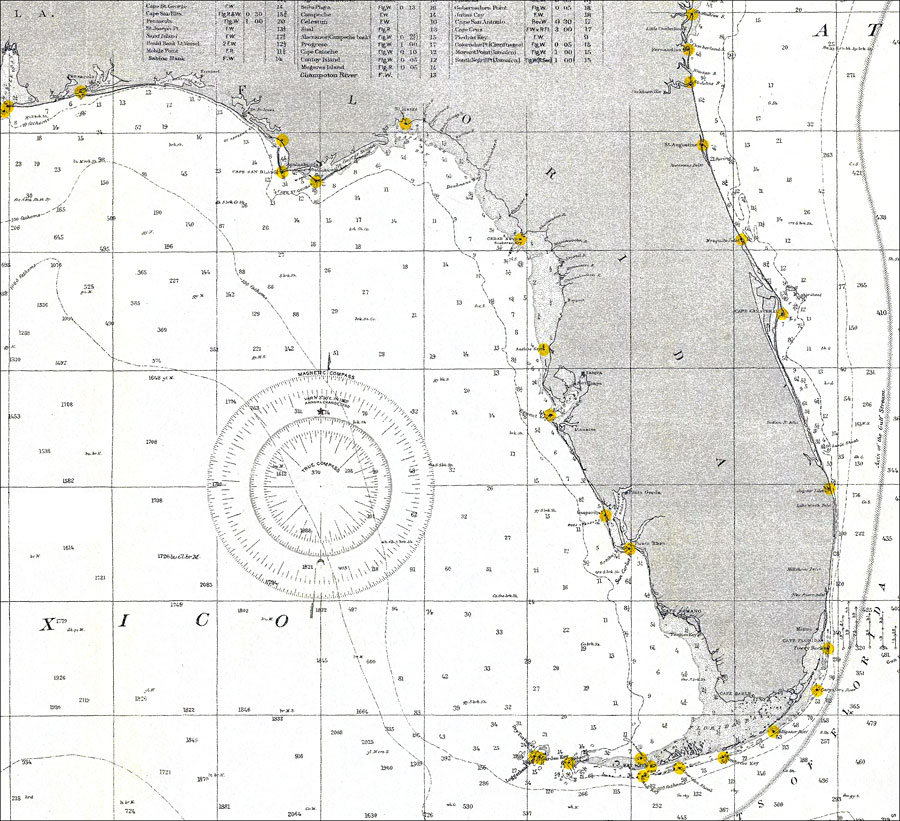
Description: A portion of the U.S. Department of Commerce and Labor map of the Gulf of Mexico and the Atlantic coastline from Georgetown, South Carolina south along Georgia and peninsular Florida. This National Ocean Survey chart shows peninsular Florida with all soundings expressed in fathoms and depth lines at 10,100, and 1,000 fathoms. Navigational aids such as the direction and velocity of the Gulf Stream, measures of magnetic declination variances, and lighthouses are shown. N.O.A.A. map reference: 1007-2-1905. Key to NOAA maps. PLEASE NOTE: This historical data is not to be used for navigation or navigation planning. The Florida Center for Instructional Technology (FCIT) does not assume responsibility for the improper use of these data.
Place Names: 1900-1919, Cape Canaveral, Miami, Tampa
ISO Topic Categories: boundaries, inlandWaters, oceans, transportation
Keywords: Gulf of Mexico, physical, hydrological, transportation, political, physical features, country borders, water routes, water depths, boundaries, inlandWaters, oceans, transportation, Mercator, 1905
Source: National Oceanic and Atmospheric Administration, (Washington, DC: United States Coast and Geodetic Survey, 1905)
Map Credit: Courtesy the U.S. National Oceanic and Atmospheric Administration |
|