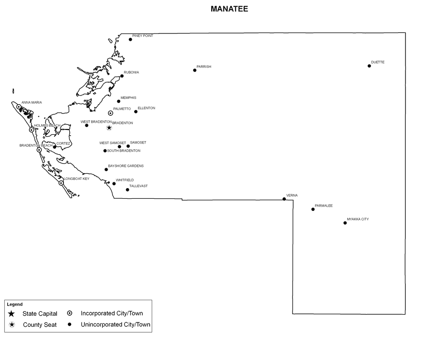
Description: This is a black and white city map of Manatee county, 2009. It shows the location with names of unincorporated cities/towns (black dot) such as Parrish, incorporated cities/towns (circle with dot) such as Anna Maria, and the county seat (circle with star) at Bradenton.
Place Names: Manatee, Myakka City, �Parmalee, �Duette, �Verna, �Parrish, �Piney Point, �Ellenton, �Rubonia, �Memphis, �Palmetto, �Bradenton, �Anna Maria, �Holmes Beach, �Cortez, �Longboat Key, �Tallevast, �Bayshore Gardens, �Samoset, �West Samoset, �West Bradenton, �Bradenton Beach, �South Bradenton, �Whitfield
ISO Topic Categories: boundaries
Keywords: Manatee County Cities with Labels, political, �kcitieslabeled, �kcities, county borders, boundaries, Albers_Conical_Equal,2009
Source: Florida Center for Instructional Technology, Exploring Florida: Social Studies Resources �for Students and Teachers (Tampa, FL: University of South Florida, 2009)
Map Credit: Courtesy of the Florida Center for Instructional Technology, Author: Samer Slaiby |
|