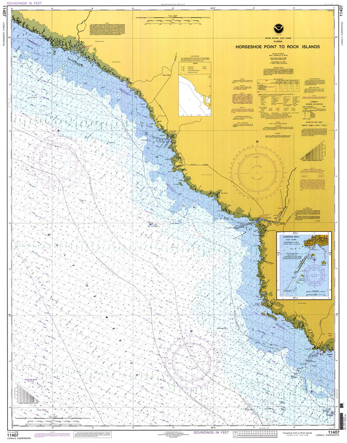
Description: A National Oceanic and Atmospheric Administration map showing the U. S. Gulf Coast from Horseshoe Point to Rock Islands current to 1997. This National Ocean Survey chart shows all soundings expressed in feet. Navigational aids such as lights and measures of magnetic declination variances are shown as well as submarine pipelines, cables and obstructions. The map scale is 1:80,000. Chart is LORAN-A/C overprinted. North American Datum of 1983 is used. N.O.A.A. map reference: 11407-8-1997. Key to NOAA maps. PLEASE NOTE: This historical data is not to be used for navigation or navigation planning. The Florida Center for Instructional Technology (FCIT) does not assume responsibility for the improper use of these data.
Place Names: 1950-1999, Horseshoe Point, Horseshoe Beach, Rock Islands, Steinhatchee River, Deadman Bay, Pepperfish Keys
ISO Topic Categories: inlandWaters, transportation
Keywords: Horseshoe Point to Rock Islands, physical, transportation, hydrological, water routes, water depths, inlandWaters, transportation, Mercator, 1997
Source: National Oceanic and Atmospheric Administration, National Ocean Survey (Washington, DC: U. S. Department of Commerce, 1997)
Map Credit: Courtesy the U.S. National Oceanic and Atmospheric Administration |
|