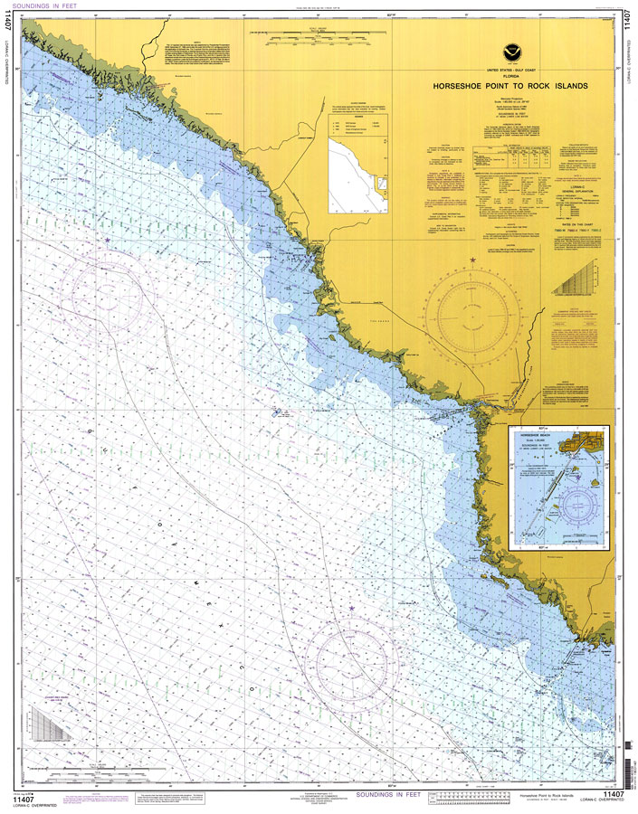
Description: A National Oceanic and Atmospheric Administration map of the Florida Gulf Coast from Horseshoe Point to the Rock Islands. This Gulf Coast Survey chart shows all soundings expressed in feet. Navigational aids such as safety fairways, visual markers such as lights, beacons, radio and water towers, and measures of magnetic declination variances are shown. Map also includes the Three Nautical Mile Line, Natural Resources Boundary, and Territorial Sea and Contiguous Zone. The map scale is 1:80,000. North American Datum 1983 and World Geodetic System 1984 are used. Chart is LORAN-C overprinted. N.O.A.A. map reference: 11407-8-1997. Key to NOAA maps. PLEASE NOTE: This historical data is not to be used for navigation or navigation planning. The Florida Center for Instructional Technology (FCIT) does not assume responsibility for the improper use of these data.
Place Names: Taylor, Steinhatchee
ISO Topic Categories: oceans, inlandWaters, transportation
Keywords: Horseshoe Point to Rock Islands, physical, hydrological, transportation, physical features, roads, water depths, oceans, inlandWaters, transportation, Mercator, 1997
Source: National Oceanic and Atmospheric Administration, Gulf Coast Survey (Washington, DC: National Oceanic and Atmospheric Administration, 1997)
Map Credit: Courtesy the U.S. National Oceanic and Atmospheric Administration |
|