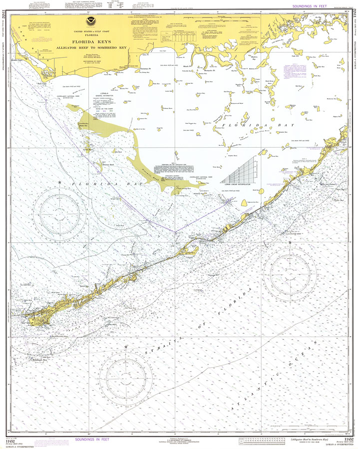
Description: A National Oceanic and Atmospheric Administration map of the Florida Keys between Alligator Reef to Sombrero Key current to1978. This Survey chart shows all soundings expressed in feet. Navigational aids such as lights, beacons, buoys and measures of magnetic declination variances are shown as well as obstructions such as shoals, submerged piles, and, fixed bridges. The map scale is 1:80,000. North American Datum 1927 is used. Key to NOAA maps.
Place Names: Monroe, Plantation Key, Matecumbe Key, Tavernier, Vaca Key, Marathon
ISO Topic Categories: transportation, inlandWaters
Keywords: Florida Keys, Alligator Reef to Sombrero Key, physical, hydrological, transportation, physical features, water routes, water depths, transportation, inlandWaters, Mercator, 1978
Source: National Oceanic and Atmospheric Administration, Gulf Coast Survey (Washington, DC: National Oceanic and Atmospheric Administration, 1978)
Map Credit: Courtesy the U.S. National Oceanic and Atmospheric Administration |
|