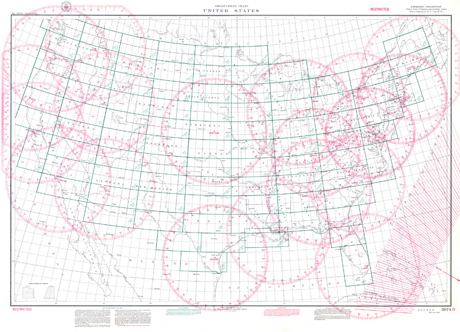
Description: 1941 map of the United States, showing political boundaries including national and state borders. Depiction of compass roses indicate major cities where possible flight paths between two points could be plotted. A straight line drawn between any two points signifies the measurement of the shortest distance betweent them. The scale is 1:5094000. Key to NOAA maps.
Place Names: 1920-1949, Miami, Jacksonville, Tallahassee, Tampa, St Petersburg, Pensacola, Key West, Daytona Beach
ISO Topic Categories: boundaries, geoscientificInformation, inlandWaters, oceans, transportation
Keywords: Great Circle Chart : United States, political, physical, transportation, physical features, country borders, major political subdivisions, air routes, boundaries, geoscientificInformation, inlandWaters, oceans, transportation, Gnomonic, 1941
Source: United States Coast and Geodetic Survey, (Washington D.C., DC: United States Coast and Geodetic Survey, 1941)
Map Credit: Courtesy of the United States National Oceanic and Atmospheric Administration |
|