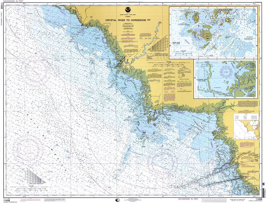
Description: A National Oceanic and Atmospheric Administration map of the Gulf Coast of Florida from Crystal River to Horseshoe Point. This Gulf Coast Survey chart shows all soundings expressed in feet. Navigational aids such as safety fairways, visual markers such as lights, beacons, radio and water towers, and measures of magnetic declination variances are shown as well as obstructions such as overhead cables and submerged wreckage and piles. The map scale is 1:80,000. North American Datum 1983 and World Geodetic System 1984 are used. Map is LORAN-C overprinted. Key to NOAA maps.
Place Names: 1950-1999, Crystal River, Suwannee
ISO Topic Categories: transportation, oceans, inlandWaters
Keywords: Crystal River to Horseshoe Point, physical, transportation, hydrological, physical features, roads, water depths, transportation, oceans, inlandWaters, Mercator, 1998
Source: National Oceanic and Atmospheric Administration, (Washington, DC: National Oceanic and Atmospheric Administration, 1998)
Map Credit: Courtesy of the U.S. National Oceanic and Atmospheric Administration |
|