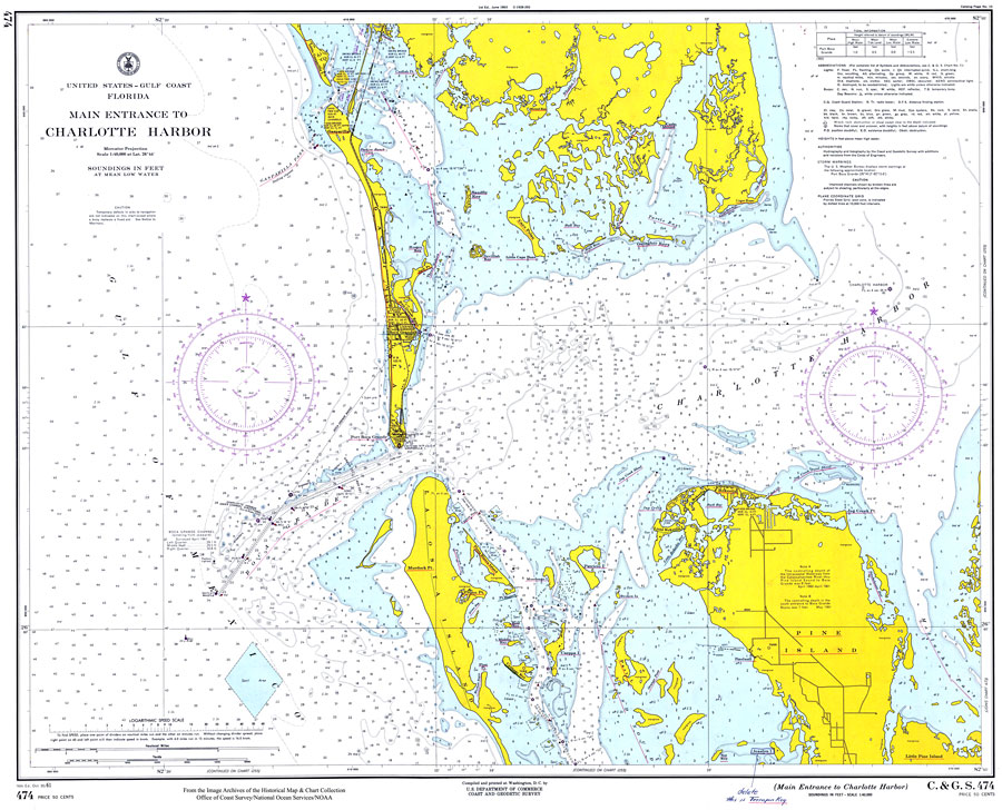
Description: A National Oceanic and Atmospheric Administration map of the area Charlotte Harbor current to1961. This Survey chart shows all soundings and heights expressed in feet. Navigational aids such as lights, beacons, buoys and measures of magnetic declination variances are shown as well as obstructions such as shoals, submerged piles, wreckage, fixed bridges, and overhead cables. The map scale is 1:40,000. Key to NOAA maps.
Place Names: Charlotte, Charlotte Harbor
ISO Topic Categories: inlandWaters, oceans, transportation
Keywords: Main Entrance to Charlotte Harbor, physical, transportation, hydrological, physical features, water routes, water depths, inlandWaters, oceans, transportation, Mercator, Unknown,1961
Source: U.S. Coast and Geodetic Survey, Gulf Survey (Washington, D.C.: U.S. Coast and Geodetic Survey, 1961)
Map Credit: Courtesy of the U.S. National Oceanic and Atmospheric Administration |
|