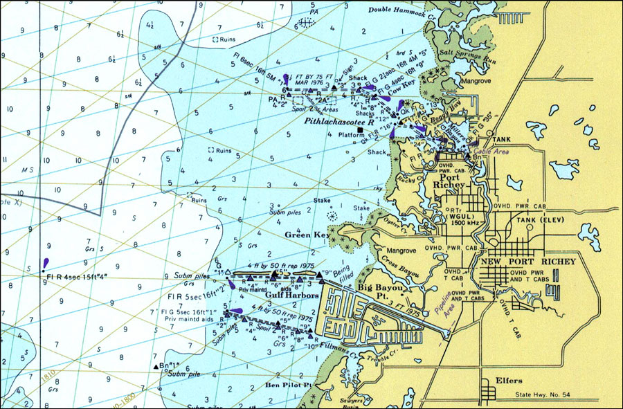
Description: A National Oceanic and Atmospheric Administration map of New Port Richey and the entrance to the Pithlachascotee River. This survey chart shows all soundings expressed in feet. Navigational aids such as safety fairways, and visual markers such as lights and beacons are shown as well as obstructions such as submerged ruins and piles. Map is LORAN-A overprinted. Key to NOAA maps.
Place Names: Pasco, New Port Richey, Port Richey
ISO Topic Categories: transportation, oceans, inlandWaters
Keywords: New Port Richey, physical, hydrological, transportation, physical features, roads, water depths, transportation, oceans, inlandWaters, Unknown,1977
Source: National Oceanic and Atmospheric Administraton, (Washington, DC: United States Coast and Geodetic Survey, 1977)
Map Credit: Courtesy of the U.S. National Oceanic and Atmospheric Administration |
|