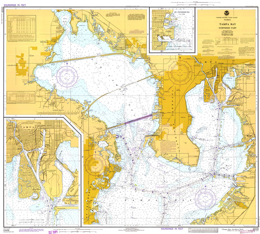
Description: A National Oceanic and Atmospheric Administration map of the northern part of Tampa Bay. This Gulf Coast Survey chart shows all soundings expressed in feet. Navigational aids such as safety fairways, and visual markers such as lights, buoys, and beacons are shown as well as obstructions such as fixed bridges, submerged ruins, pipes, cables, and piles. Measure of magnetic variance and annual change included. Scale 1:40,000. North American 1927 Datum used. Key to NOAA maps.
Place Names: 1950-1999, Tampa, St Petersburg, Clearwater
ISO Topic Categories: transportation, inlandWaters
Keywords: Tampa Bay Northern Part, physical, transportation, hydrological, physical features, roads, water routes, water depths, transportation, inlandWaters, Mercator, 1977
Source: National Oceanic and Atmospheric Administration, National Ocean Survey (Washington, DC: U. S. Department of Commerce, 1977)
Map Credit: Courtesy of the U.S. National Oceanic and Atmospheric Administration |
|