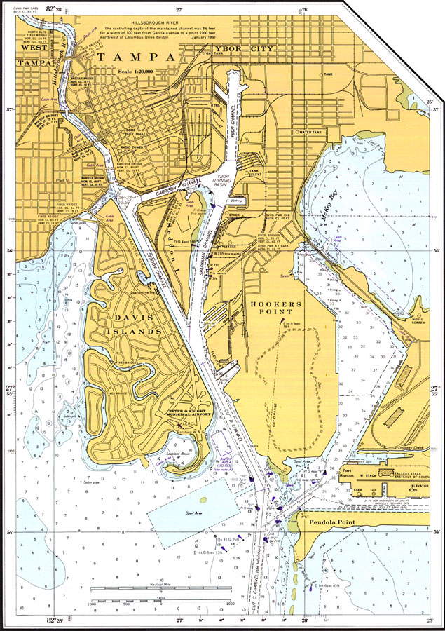
Description: A National Oceanic and Atmospheric Administration map of Tampa and its channels. This Gulf Coast Survey chart shows all soundings expressed in feet. Navigational aids such as safety fairways and radio towers, and visual markers such as lights, buoys, and beacons are shown as well as obstructions such as submerged piles and cables. Map also includes some street names and major landmarks. Scale 1:20,000. Key to NOAA maps.
Place Names: Hillsborough, Tampa
ISO Topic Categories: transportation, inlandWaters
Keywords: Tampa, physical, transportation, hydrological, physical features, roads, water routes, water depths, transportation, inlandWaters, Unknown,1977
Source: National Oceanic and Atmospheric Administration, National Ocean Survey (Washington, DC: U. S. Department of Commerce, 1977)
Map Credit: Courtesy of the U.S. National Oceanic and Atmospheric Administration |
|