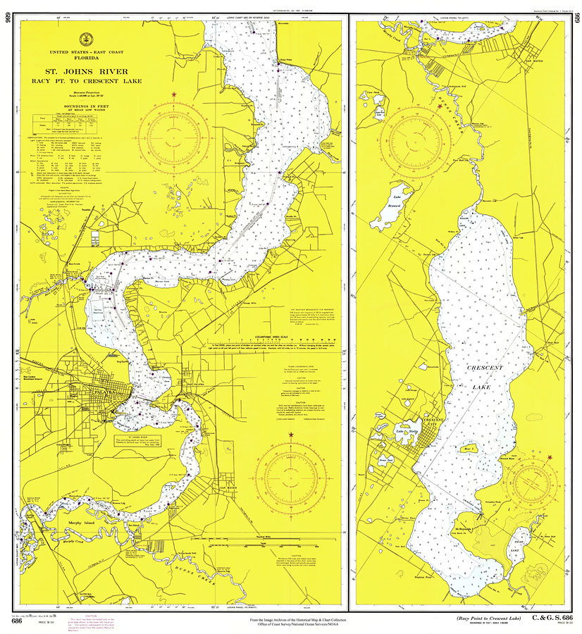
Description: A National Oceanic and Atmospheric Administration map of the St. Johns River, from Racy Point to Crescent Lake current to1970. This Survey chart shows all soundings expressed in feet. Navigational aids such as lights, beacons, buoys and measures of magnetic declination variances are shown as well as obstructions such as shoals, submerged piles, wreckage, fixed bridges, and overhead cables. The map scale is 1:40,000. Key to NOAA maps.
Place Names: 1950-1999, Jacksonville
ISO Topic Categories: inlandWaters, transportation
Keywords: St. Johns River: Racy Point to Crescent Lake, hydrological, transportation, physical, physical features, water routes, water depths, inlandWaters, transportation, Mercator, 1970
Source: Office of Coast Survey, United States-East Coast: Florida (Washington, DC: NOAA, 1970)
Map Credit: Courtesy the U.S. National Oceanic and Atmospheric Administration |
|