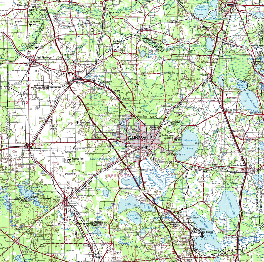
Description: A National Oceanic and Atmospheric Administration map of Alachua County current to1975. This map shows Alachua county and its jurisdicitions along with surrounding counties. Navigational aids such as lights, beacons, buoys and measures of magnetic declination variances are shown as well as obstructions such as shoals, submerged piles, wreckage, fixed bridges, and overhead cables. The map scale is 1:250,000. North Geodetic Vertical Datum 1929 is used. Key to NOAA maps.
Place Names: Alachua, Alachua, Archer, Arrendondo, Bell, Frankland, Ft. Fanning, Gainsville, Hawthorne, Joppa, High Springs, Kanapaha, La Crosse, Micanopy, Newberry, Newnansville, Orange Heights, Rochelle, Trenton, Waldo
ISO Topic Categories: transportation, inlandWaters, boundaries
Keywords: Alachua County, physical, political, transportation, physical features, county borders, local jurisdictions, major political subdivisions, water routes, railroads, transportation, inlandWaters, boundaries, Transverse_Mercator, 1975
Source: U.S. Geologic Survey and National Ocean Service, Eastern United States (Reston, VA: NOAA, 1975)
Map Credit: Courtesy the U.S. National Oceanic and Atmospheric Administration |
|