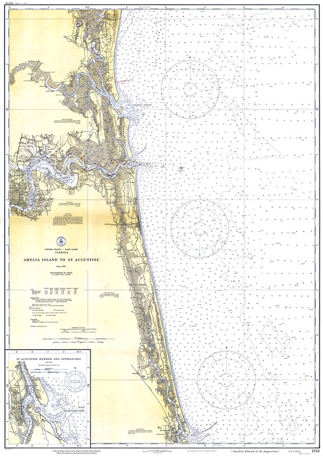
Description: A US Coast and Geodetic Survey map of the east coast of Florida from Amelia Island to St. Augustine, 1933. This East Coast Survey chart shows all soundings expressed in feet. Navigational aids such as safety fairways, and visual markers such as lights, buoys, and beacons are shown as well as obstructions such as fixed bridges. Measure of magnetic variance and annual change included. Scale 1:80,000. Key to NOAA maps.
Place Names: 1920-1949, Saint Augustine, Jacksonville, Fernandina
ISO Topic Categories: transportation, oceans, inlandWaters, elevation
Keywords: Amelia Island to St. Augustine, physical, transportation, hydrological, physical features, roads, water routes, water depths, transportation, oceans, inlandWaters, elevation, Unknown,1933
Source: US Coast and Geodetic Survey, East Coast Survey (Washington, DC: US Coast and Geodetic Survey, 1933)
Map Credit: Courtesy the U.S. National Oceanic and Atmospheric Administration |
|