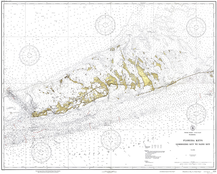
Description: A US Coast and Geodetic Survey map of the Florida Keys from Sombrero Key to Sand Key, 1932. This survey chart shows all soundings expressed in feet. Navigational aids such as safety fairways, and visual markers such as lights, buoys, and beacons are shown as well as obstructions such as fixed bridges and submerged rocks. Measure of magnetic variance and annual change included. Scale 1:80,000. N.O.A.A. map reference: 1251_7-1933. Key to NOAA maps. PLEASE NOTE: This historical data is not to be used for navigation or navigation planning. The Florida Center for Instructional Technology (FCIT) does not assume responsibility for the improper use of these data.
Place Names: Monroe, Key West, Big Pine
ISO Topic Categories: transportation, oceans, elevation
Keywords: Florida Keys: Sombrero Key to Sand Key, physical, transportation, hydrological, physical features, roads, railroads, water routes, water depths, transportation, oceans, elevation, Unknown,1932
Source: US Coast and Geodetic Survey, Gulf Coast Survey (Washington, DC: US Coast and Geodetic Survey, 1932)
Map Credit: Courtesy the U.S. National Oceanic and Atmospheric Administration |
|