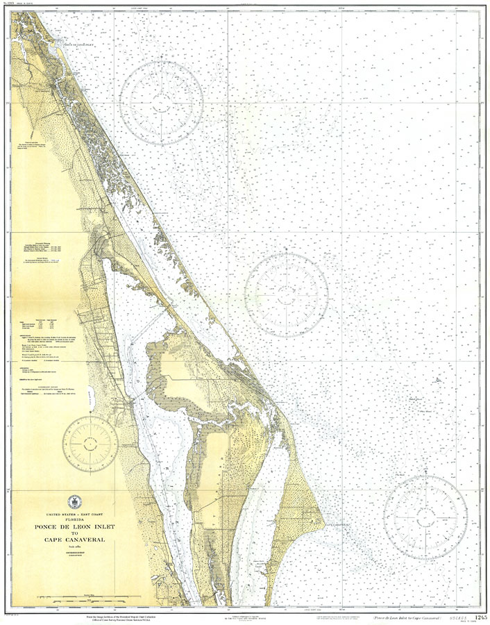
Description: A National Oceanic and Atmospheric Administration map of the area between Ponce De Leon Inlet and Cape Canaveral current to 1931. This National Ocean Survey chart shows all soundings expressed in feet. Navigational aids such as lights, beacons, buoys and measures of magnetic declination variances are shown as well as obstructions such as shoals, submerged piles, fixed bridges, and submerged wreckage. Intracoastal waterway table is included. The map scale is 1:80,000. Key to NOAA maps.
Place Names: 1920-1949, Cape Canaveral, Ponce De Leon Inlet, New Smyrna, Cocoa, Titusville, Banana River, Merritt Island, Indian River, Mosquito Lagoon,
ISO Topic Categories: inlandWaters, oceans, transportation
Keywords: Ponce De Leon Inlet to Cape Canaveral, physical, transportation, hydrological, physical features, railroads, water routes, roads, water depths, inlandWaters, oceans, transportation, Unknown,1931
Source: National Oceanic and Atmospheric Administration, East Coast Survey (Washington, DC: National Oceanic and Atmospheric Administration, 1931)
Map Credit: Courtesy the U.S. National Oceanic and Atmospheric Administration |
|