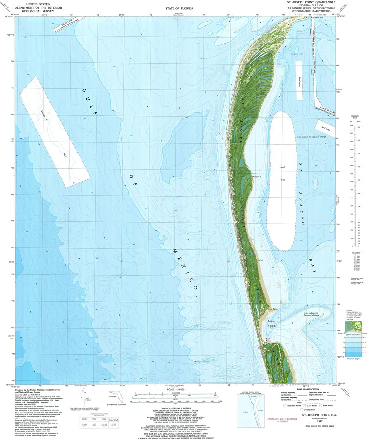
Description: A National Ocean Survey map of St. Joseph Point current to 1982. This orthophotomap shows both topographic and bathymetric features. Topographic and bathymetric contour intervals are shown in meters. Topographic contour lines are shown at 2-meter intervals with supplemental contour intervals at 1 meter. Bathymetric contour intervals are at 1 meter with supplementary 0.5 meter contours. Bathymetric datum is mean lower low water. The map shows drylands, wetlands, and partially submerged land exposed at mean low tide. Spoil areas, dump sites and ship channel are included. This information is not intended for navigational purposes. The National Geodetic Vertical Datum of 1929 is used in this map. The projection used 1927 North American Datum with reference on converting to North American Datum 1983. The map scale is 1:24,000. NOAA Map Reference: 29085_G4_TB_024-00-1982. Key to USGS maps. PLEASE NOTE: This historical data is not to be used for navigation or navigation planning. The Florida Center for Instructional Technology (FCIT) does not assume responsibility for the improper use of these data.
Place Names: Gulf, Saint Josephs Bay, Saint Joseph Peninsula State Park, Eagle Harbor,
ISO Topic Categories:
Keywords: St. Joseph Point, physical, transportation, hydrological, physical features, topographical, roads, water routes, water depths, Lambert_Azimuthal_Equal_Area, Transverse_Mercator, 1982
Source: USGS and NOAA, St. Joseph Point Quadrangle (Reston, VA: United States Geological Survey, 1982)
Map Credit: Courtesy the U.S. National Oceanic and Atmospheric Administration |
|