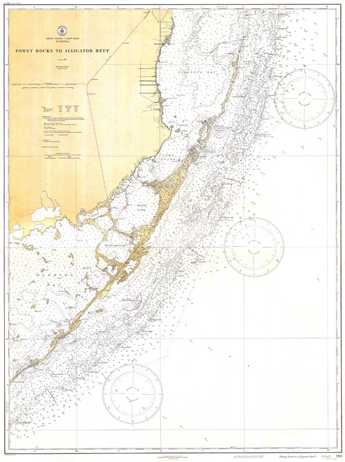
Description: A US Coast and Geodetic Survey map of South Florida and the upper Florida Keys from Fowey Rocks to Alligator Reef current to 1933. This East Coast Survey chart shows all soundings expressed in feet. Navigational aids such as lights, beacons, buoys and measures of magnetic declination variances are shown as well as obstructions such as shoals, fixed bridges, and submerged rocks. The map scale is 1:80,000. Key to NOAA maps.
Place Names: 1920-1949, Homestead, Florida City, Key Largo, Tavernier, Islamorada
ISO Topic Categories: transportation, oceans, elevation
Keywords: Fowey Rocks to Alligator Reef, physical, transportation, hydrological, physical features, railroads, water routes, roads, water depths, transportation, oceans, elevation, Unknown,1933
Source: US Coast and Geodetic Survey, East Coast Survey (Washington, DC: US Coast and Geodetic Survey, 1931)
Map Credit: Courtesy the U.S. National Oceanic and Atmospheric Administration |
|