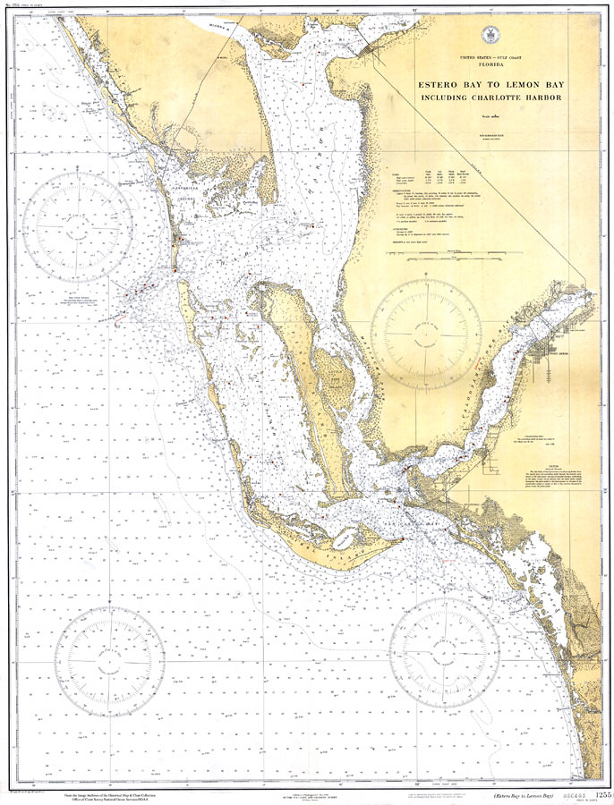
Description: A US Coast and Geodetic Survey map of the Gulf Coast of Florida from Estero Bay to Lemon Bay, including Charlotte Harbor, current to 1929. This Gulf Coast Survey chart shows all soundings expressed in feet. Navigational aids such as lights, beacons, buoys and measures of magnetic declination variances are shown as well as obstructions such as bridges, submerged rocks, and piles. The map scale is 1:80,000. Key to NOAA maps.
Place Names: 1920-1949, Boca Grande, Punta Gorda, Fort Myers, Palmetto Point
ISO Topic Categories: transportation, oceans, inlandWaters, elevation
Keywords: Estero Bay to Lemon Bay, physical, transportation, hydrological, physical features, roads, railroads, water routes, water depths, transportation, oceans, inlandWaters, elevation, Unknown,1929
Source: US Coast and Geodetic Survey, Gulf Coast Survey (Washginton, DC: US Coast and Geodetic Survey, 1929)
Map Credit: Courtesy the U.S. National Oceanic and Atmospheric Administration |
|