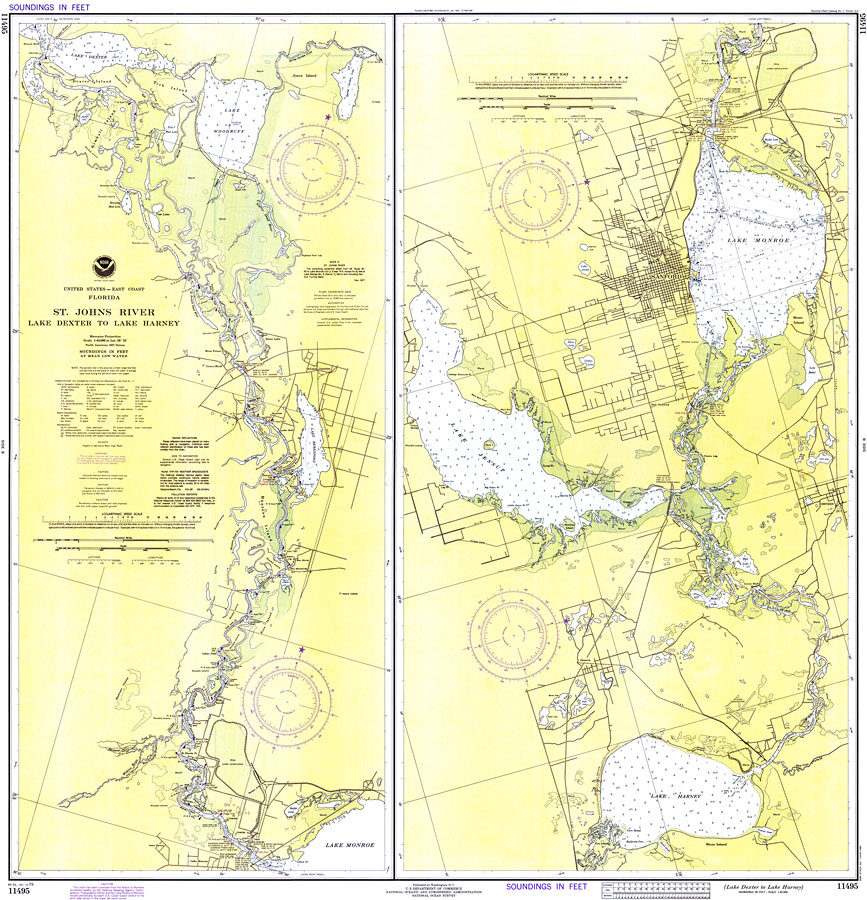
Description: A National Oceanic and Atmospheric Administration map of the St. Johns River from Lake Dexter to Lake Harney, current to 1979. This National Ocean Survey chart shows all soundings expressed in feet. Navigational aids such as lights, beacons, buoys and measures of magnetic declination variances are shown as well as obstructions such as fixed bridges, submerged cable areas, pipes, and piles. North American 1927 Datum used. The map scale is 1:40,000. Key to NOAA maps.
Place Names: 1950-1999, Riverside, Deland Junction, River Forest, Crows Bluff, High Banks, Lake Monroe, Geneva, Osteen, Sanford, Enterprise
ISO Topic Categories: transportation, inlandWaters, elevation
Keywords: St. Johns River: Lake Dexter to Lake Harney, physical, transportation, hydrological, physical features, roads, railroads, water routes, water depths, transportation, inlandWaters, elevation, Mercator, 1979
Source: National Oceanic and Atmospheric Administration, National Ocean Survey (Washington, DC: National Oceanic and Atmospheric Administration, 1979)
Map Credit: Courtesy the U.S. National Oceanic and Atmospheric Administration |
|